Newb Sonar - Fish Finder Questions - The Fine Points; How to Make Best Use of It?

Brian Miller

Be vewy vewy quiet, I'm hunting Cutthwoat Twout
Forum Supporter
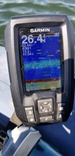
I been fly fishing for almost 50 years but haven't fished lakes much. I am brand new to fish finder-sonar and just bought a nice Garmin Striker 4 fish finder. My only frame of reference is USAF fighter interceptor weapons system radar that displayed target relative vertical & horizontal position, distance, and its direction of travel. That's probably working against me and I need try forgetting all that I ever knew about radar displays.
I know the Striker sends out and receives ultrasound waves in a cone to paint the bottom, shows the depth, structure, beeps and displays a fish icon when it thinks it's detected a fish with the depth...
I know that the "Edge" "A-Scope" display shows a realtime image of what's straight down in the sonar cone, the cone diameter... The narrow Edge A-Scope display is always saturated with bottom return data. Fish are displayed as changing colors (denoting target depth & distance) in the water column cone above the bottom saturation. When a fish "arch" or a fish icon displays beyond the Edge A-Scope display, it's old data and no longer below me. If I am moving I only know I passed over a fish, and the depth.
Can any fish finder experts out there help educate me on...
  1. If the fish is 5ft above the bottom with no structure nearby is it likely cruising for food?
  2. If the fish is moving, is there any way to tell what direction, how fast... ?
  3. Ultimately, how can I use the display to help me target the fish that just passed through the cone?
  4. If you see a fish painted near structure (including the bottom) how do you target a fish that was just painted on the display?
  5. If you are trolling or just underway, how do you target a fish that was just painted on the display?
Any videos you can recommend that will help replace my prior radar experience?

*edited to correct the realtime feature name
 
Last edited:

headduck

Steelhead
A couple things I learned in my limited experince.

Everything you see is the past.

The depth is the straight line distance from the transducer in all directions... a 3d cone of coverage.

Understand cone angle and how coverage area relates to depth.

Long dark arches are fish spending more time drifting with the cone, and sometimes below. Partials are in and out. Full arch is fully in the cone but usually static.

I usually assume new marks are coming from in front of my direction of travel, but not always... could be fish coming into the cone from any direction.

Team colibri is a great resource on FF dorkery.
 

clarkman

average member
Forum Supporter
This may or may not help you all that much....I didn't buy my little Garmin Striker to help me target individual fish. I bought it for structure, water temp, depth.

I'm also using it primarily for muskies, so if I mark one, I know that I'm in the right neighborhood (they can find flies from quite a ways away as their lateral line is pretty damn good).

I guess that doesn't really specifically answer any of your questions, sorry 'bout that.

What fish finder do you have? I ended up just doing a search on Youtube and it gave me all sorts of things both specific to mine and general to fish finders.
 

Scudley Do Right

Life of the Party
I would agree with clarkman. I am not using it to target specific fish. It just provides you with more info on whats going on under the surface. You will know what depth to target based on where you are seeing the arches in general. I find them more useful when salmon fishing and I am looking for balled bait.
 

Brian Miller

Be vewy vewy quiet, I'm hunting Cutthwoat Twout
Forum Supporter
Thanks for the replies so far!

The depth is the straight line distance from the transducer in all directions... a 3d cone of coverage.

Understand cone angle and how coverage area relates to depth.
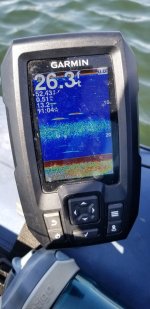
The Garmin Striker Vivid 4cv has an "Edge" "A-Scope" display option for a 1/2" pane down the right side of the display showing real time water column data inside the cone. At the bottom of that Edge A-Scope pane is a number displaying the cone width at any given moment (depth). I actually was able to identify a fish being painted in the cone before it became an arch or showed up as a fish icon with the depth displayed next to it.
I usually assume new marks are coming from in front of my direction of travel, but not always... could be fish coming into the cone from any direction.
+1, best I can do so far, and may be all that the FF is designed to show.

I didn't buy my little Garmin Striker to help me target individual fish. I bought it for structure, water temp, depth.
Structure, I think that's a pretty important piece of info, especially if there are arches (or fish icons) next to it.
I'm brand new to this.
What does knowing the surface temperature tell you about fish below the surface?
Do you use the depth information for how to rig the the rod and present the fly?
I ended up just doing a search on Youtube and it gave me all sorts of things both specific to mine and general to fish finders.
I've seen a YT channel with good videos on the Garmin ff's features, and what you can and can't determine from what's on the display. But I haven't seen anything about what the angler should do with the information on the display.

*edited to correct the realtime feature name
 
Last edited:
clarkman

average member
Forum Supporter
Thanks for the replies so far!


The Garmin Striker Vivid 4cv has an "Edge" display option for a 1/2" pane down the right side of the display showing real time water column data inside the cone. At the bottom of that Edge pane is a number displaying the cone width at any given moment (depth). I actually was able to identify a fish being painted in the cone before it became an arch or showed up as a fish icon with the depth displayed next to it.

+1, best I can do so far, and may be all that the FF is designed to show.


Structure, I think that's a pretty important piece of info, especially if there are arches (or fish icons) next to it.
I'm brand new to this.
What does knowing the surface temperature tell you about fish below the surface?
Do you use the depth information for how to rig the the rod and present the fly?

I've seen a YT channel with good videos on the Garmin ff's features, and what you can and can't determine from what's on the display. But I haven't seen anything about what the angler should do with the information on the display.
Surface temp just gives me a very general idea since once you get down a couple of feet, it's always a bit different. For depth, at least how I use it for muskies, I want to make sure I'm not fishing over water that's much deeper than 25-30' or so. I'll see if I can find the channel I used on YT that was the most useful for interpreting things. I can't remember off the top of my head.
 

Haggis57

Steelhead
Forum Supporter
I had my Striker plus 4 out earlier this week for the first time. Last night I went through this guy's YT channel and found some interesting suggestions, including the A-Scope. He does provide some recommended setting for some of the features that I modified on my unit to try next time. He does show some decent graphics on the transducer cone and how to interpret the information you are seeing. I found it useful to have my unit on beside the computer screen to walk through the menus as he was explaining.

I used a Fishin Buddy 120 prior to this and primarily relied on it for structure and depth as a lot of other guys. I did occasionally get a hookup with the side sonar. At this point the Garmin seems like over-kill for the less than 30 ft deep lakes I've been fishing. Time will tell - I've still got the FB-120 tucked safely away!

Ken
 

iveofione

Life of the Party
Forum Supporter
I have used 'fish finders' since back in the flasher days but in all those years have never used them to find fish. Like many others, I never knew what to do with the information on the screen and the instructions that came with them were just garbage. I didn't want to spend time staring at a screen to begin with, the only two pieces of information I really need are structure and depth and I can read those at a glance. But for chironomid fishing they are invaluable and for casting and stripping and trolling they are important in deciding what depth of sink line to be using.

Finding dropoffs and channels in lakes will put you on fish even if they don't show up on a screen. I would suggest that watching the water for insect activity, watching the swallows and noting where fish are rising on the lake and spotting underwater structure is of equal value to staring at a screen for a fish image. In some deep lakes, like Coffeepot, I have let out an entire Type 6 or Type 7 line and caught fish at tremendous depths for a fly line. Without the depth finder I wouldn't know if I was in 8' or 80' of water.
 

Wanative

Spawned out Chum
Forum Supporter
20220423_110442.jpg
I read this as 2 good trout passed directly under me. It shows a layer of either daphnia or glass worms or possibly a thermocline between 15 and 20 ft. though I think likely not a thermocline as I'm not sure stratification occurs this early. Also some more faint returns of fish further out in the cone more to the side of my position
I don't even use the edge flasher function.
I always turn off the fish icon feature as it is a filter that can interpret things as fish or bait that aren't fish or bait.
I can follow structure and contours and see weed bed edges, sunken trees or stumps etc. and adjust my flys depth or pull it in to avoid many hangups.
20220423_110439.jpg
The sonar gives me a better idea of the depths most of the trout are hanging out in.
 

Brian Miller

Be vewy vewy quiet, I'm hunting Cutthwoat Twout
Forum Supporter
I had my Striker plus 4 out earlier this week for the first time. Last night I went through this guy's YT channel and found some interesting suggestions, including the A-Scope. He does provide some recommended setting for some of the features that I modified on my unit to try next time. He does show some decent graphics on the transducer cone and how to interpret the information you are seeing. I found it useful to have my unit on beside the computer screen to walk through the menus as he was explaining.

I used a Fishin Buddy 120 prior to this and primarily relied on it for structure and depth as a lot of other guys. I did occasionally get a hookup with the side sonar. At this point the Garmin seems like over-kill for the less than 30 ft deep lakes I've been fishing. Time will tell - I've still got the FB-120 tucked safely away!

Ken
The 1Cast 1Fish guy you linked to is the best series I've seen on what the Garmin Striker 4+cv and vivid units can display. By the end of my first day I was seeing fish being painted in the cone on the A-Scope before they were displayed in the main display pane. I did post a question on a video asking "Now that I have all that information, what do I do with it to "catch more fish"?"; quoting his ending statement for that video. I haven't been notified of a response yet.
 
Last edited:

onefish

Steelhead
There are dozens, if not hundreds, of excellent youtube videos on the various makes and models of fishfinders/sounders/graphs/chartplotters. All makes and models are better than floating around just watching for some birds to help you out. There is a lot going on in 15 feet and deeper that is totally inconspicuous of any surface action, and the best way to get that info is with your electronics.
Watch videos on your unit, take the manual on the water so you can learn, especially on slow days, and for goodness sakes, turn the freaking fish id OFF and learn to read the raw data yourself. After a while you will just add the info of your electronics to the other info you use to help you get into more fish.
On my unit ( lowrance elite fs 7 ) I keep my 2d on 83hz for the widest cone angle, my downscan on 800hz for the best resolution of bottom structure, and the chart on so I can mark fishing locations and areas of interest.
Making my own charts and sidescan are features that are in my sounder that I have yet to utilize.
Good luck with your Garmin, I have heard lots of good things about your unit.
 

mtskibum16

Life of the Party
Structure, I think that's a pretty important piece of info, especially if there are arches (or fish icons) next to it.
I'm brand new to this.
What does knowing the surface temperature tell you about fish below the surface?
Do you use the depth information for how to rig the the rod and present the fly?
I am not an expert in the least and don't even own a sonar unit currently. However, as others are saying, the main useful information you are going to get is the depth of the water, structure of the bottom, and potentially the target depth fish are holding at. You likely won't use the unit to specifically cast to and catch an individual fish you mark.

So like in @Wanative post, if he's marking fish consistently in 10-15' of water, that tells you to target that depth. Based on the location and type of fish you are targeting, you would want to decide what the primary food source at that depth would be and choose a presentation that will allow you to effectively fish that depth. Maybe the fish at that depth aren't cooperating, so then you move on to the fish being marked along the bottom and target that depth.

Say there is some good structure but you aren't marking fish (could be that the fish are tight to the structure), knowing that there is structure and the depth it's at allows you to choose a presentation to effectively fish that structure.

When salmon fishing you will often be using it to find bait, because if there is bait there will likely be salmon. So the depth of the bait gives you a target depth to fish. If you are in 200' of water but bait is holding at 50' then that's where you probably want to be fishing.

Knowing the water surface temp can be useful in helping you determine where fish might be holding (shallow or deep), what type of food might be available (hatches), if the fish are likely pre or post spawn (bass), etc. That can help you narrow in your hunt, but you still need the knowledge of what the data means to the fishing.
 

up2nogood

Steelhead
Forum Supporter
I have used 'fish finders' since back in the flasher days but in all those years have never used them to find fish. Like many others, I never knew what to do with the information on the screen and the instructions that came with them were just garbage. I didn't want to spend time staring at a screen to begin with, the only two pieces of information I really need are structure and depth and I can read those at a glance. But for chironomid fishing they are invaluable and for casting and stripping and trolling they are important in deciding what depth of sink line to be using.

Finding dropoffs and channels in lakes will put you on fish even if they don't show up on a screen. I would suggest that watching the water for insect activity, watching the swallows and noting where fish are rising on the lake and spotting underwater structure is of equal value to staring at a screen for a fish image. In some deep lakes, like Coffeepot, I have let out an entire Type 6 or Type 7 line and caught fish at tremendous depths for a fly line. Without the depth finder I wouldn't know if I was in 8' or 80' of water.

That’s all I’ve used mine for depth , and structure.
 

Buzzy

I prefer to call them strike indicators.
Forum Supporter
That’s all I’ve used mine for depth , and structure.
Much of the time, my sonar unit (Fishin' Buddy 140C) is used primarily for depth, structure and surface temperature but there are times when the side scan function is very valuable. By simply (slowly) twisting the handle - say in a 180 degree arc, I can sometimes spot fish other than where I'm fishing, be it indicator or a sinking line. The sonar unit does give distance, but not depth, in side scan. This can be helpful, especially if I'm familiar with lake bottom contours where I'm anchored.

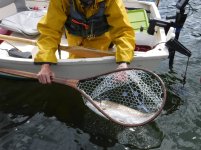
Earlier this month, I was anchored up on a marl shoal at the edge of a drop off, directly behind the bow, the water was 5' to 6' deep, the rest of the 3/4 circle deepened to just under 20-feet depth . I was turning the sonar when I spotted several fish off the starboard side (I fish off the stern) in deeper water. I made a couple casts in that direction, counted my fly down and started stripping in - the reward was a pretty darn nice fish I likely would not have caught just by looking at depth and structure:
DSCF0464.JPG
 

krusty

We're on the Road to Nowhere...
Forum Supporter
While I've been flyfishing for quite a few years I only started using a fishfinder (Garmin Striker 4) about three years ago and in my opinion it was a gamechanger.

I've found that even for lakes I've fished for decades that I had a very inaccurate understanding of their bathemetry because I had most often relied upon assumptions from surrounding topography (which often provides very poor guidance). I have bathymetric maps for pretty much every lake in WA, but who wants to look at that stuff? And it tells you nothing about where the fish are relative to your specific location.

It has saved me a lot of wasted time working areas that do not contain many fish.

For example, on a recent outting to a mountain lake I was hooking up a modest number of smaller CT along the lake's shallow margins. There was very little surface activity anywhere, but I decided to take a windrift down the deep middle (30' - 45') just to see what was going on below.

At many points I was marking large masses of fish hanging out maybe 10' from the bottom. Rigging up a type 7 line with a booby fly quickly resulted in a barrage of strikes (which were challenging but the fish I managed to net were markedly larger than those hooked along the shoreline). Lots of line out and plenty of thrown hooks.

I spent the very productive remainder of the day windrifting through the deep parts of the lake, something I might have missed without fishfinder info. In fact I'd likely not switched to a fast sinking line unless I knew the critters were down there, since I'm not keen on fishing type 7 lines unless I figure it's the best alternative.

And, of course, aquatic environments and their inhabitants represent dynamic and ever changing systems, so a fishfinder provides a very useful 'real time' adaptive tool. Two days later and the big boys might have adandoned the depths for shallow water prey.

As for spotting and pursuing individual fish via a 'fishfinder', I think that's just nonsense.
 
Last edited:

Zak

Legend
Forum Supporter
Much of the time, my sonar unit (Fishin' Buddy 140C) is used primarily for depth, structure and surface temperature but there are times when the side scan function is very valuable. By simply (slowly) twisting the handle - say in a 180 degree arc, I can sometimes spot fish other than where I'm fishing, be it indicator or a sinking line. The sonar unit does give distance, but not depth, in side scan. This can be helpful, especially if I'm familiar with lake bottom contours where I'm anchored.

Earlier this month, I was anchored up on a marl shoal at the edge of a drop off, directly behind the bow, the water was 5' to 6' deep, the rest of the 3/4 circle deepened to just under 20-feet depth . I was turning the sonar when I spotted several fish off the starboard side (I fish off the stern) in deeper water. I made a couple casts in that direction, counted my fly down and started stripping in - the reward was a pretty darn nice fish I likely would not have caught just by looking at depth and structure:
View attachment 20311
Really nice net!
 
Top